| CAVES OF THE CUETZALAN REGION, Puebla, Mexico. | ||||
| Main Index | History of Exploration >> | |||
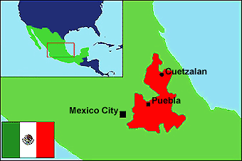
| Introduction & General Background Cuetzalan is a small, picturesque market town, in the north of the Mexican state of Puebla. The town is situated on a limestone hillside, beneath which lie many kilometres of cave passage. Collectively described as the Cuetzalan system, it was described in the late 1970's as "One of the finest and most going cave systems in the world". The area was first visited in the mid 1970's, when American,British and later Belgian cavers began exploration of the many stream sinks around the town. Between 1976 and 1980, over 35km of cave passage had been explored and surveyed. However, exploration in the area was abandoned, probably due to the fragmentation of survey data between the various groups. It was not until 1988 that interest in the area was rekindled when a small team from the British Northern Cave Club and Mexican cavers visited the area. The potential of the region was confirmed and over the following years numerous British expeditions have visited the area. The original discoveries of the 1970's have been resurveyed and the original system has been extended considerably. To date over 100km of cave passage has been explored and surveyed and each expedition returns with more leads for future exploration
Roads in the locality range from a few metalled roads connecting the
major towns to mud and stone tracks connecting the larger villages. Some of the
smaller villages and settlements can only be reached by foot, these tracks are well
trodden by locals and are in a reasonable state of repair, many of the stone clad paths
dating to pre-hispanic times. In dry weather walking can be comfortable but in the
wet can be somewhat of a chore.
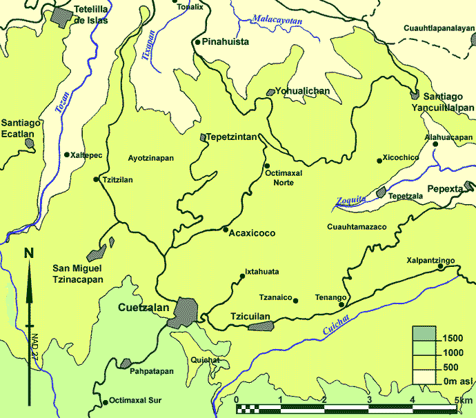
Although many of the major cave entrances are close to well worn tracks, other entrances are to be found in the middle of maize fields and coffee plantations and care needs to be taken when crossing these in order not to damage crops and upset the locals. Care also needs to be exercised used when using machetes as what may appear to be general vegetation could in fact be a local resource. In general, no problems with access have been experienced when visiting the cave entrances, although in certain areas (such as near the village of Tepetzala and the region around Cueva D'Alpazat) access can at times be a sensitive issue. The best approach when prospecting is to mention that you are searching for 'cuevas', and you will often find yourself on a guided tour of every hole in the locality, usually accompanied by hordes of children or field workers. Maps The best topographical maps of the area are published by the Instituto
Nacional De Estadistica Geografia E Informica and are available on scales of
1:50,000. Vegetation and Wildlife The principal economic crop of the region is coffee, and most of the best land is
turned over for its production. Land not used for the production of coffee is mainly
used for the cultivation of maize, the main constituent of the local diet. Yields are
typically poor, up to 60% of the maize planted is destroyed or rendered unfit due to the
weather and crop infestation. A wide range of other produce is cultivated
including potatoes, peppers and fruit such as bananas and oranges, and a wide
selection of these items can be found in the market in Cuetzalan. There are also
small areas of open pasture upon which emaciated cattle and a few horses graze. Free
range turkeys and mongrel dogs are everywhere. |
||||
| Main Index | History of Exploration >> | |||